

Localisation: United Kingdom
Types of services
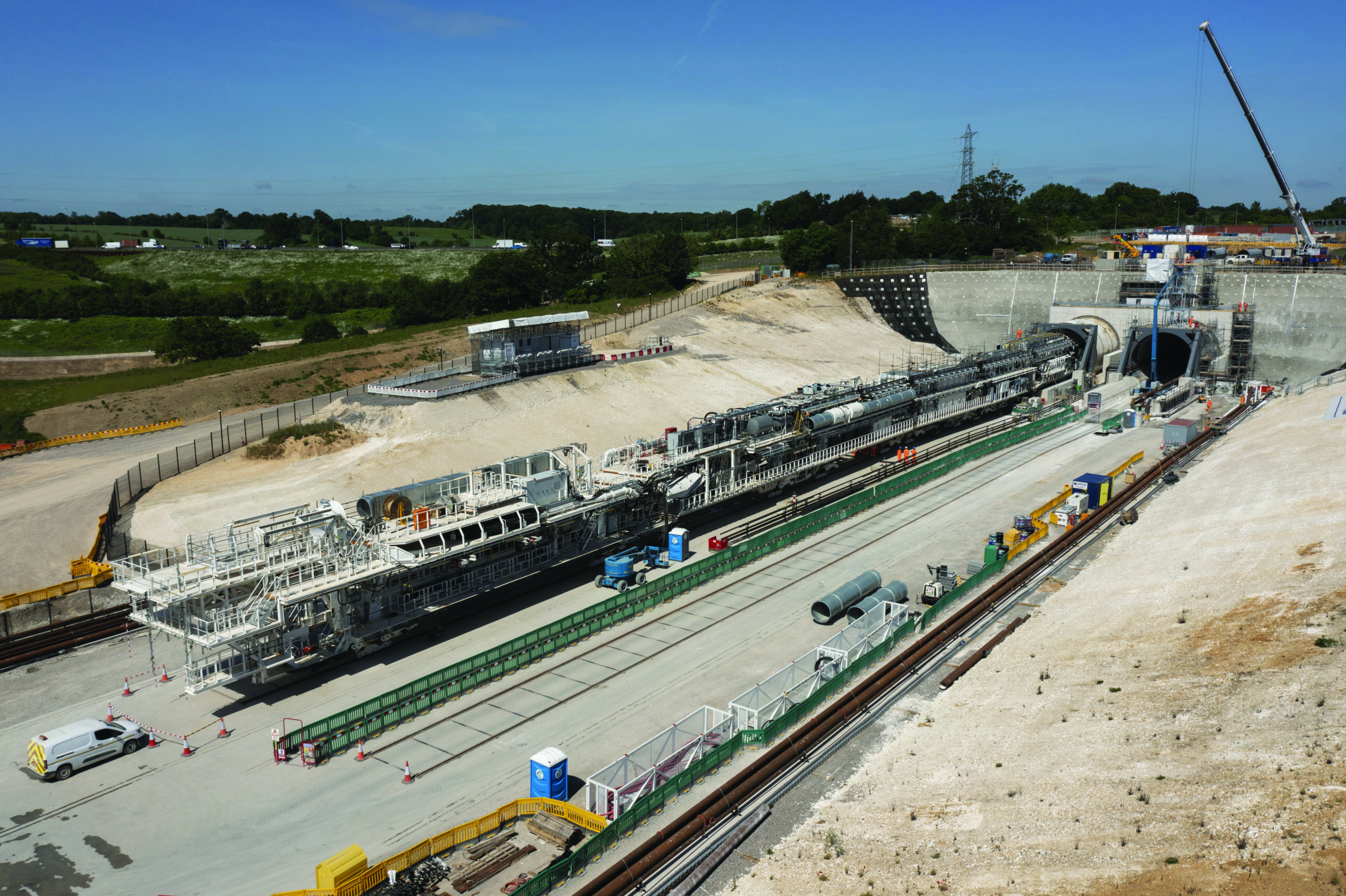
The Chilterns Tunnel is a 15.8km bored tunnel. There will be four vent shafts and one intervention shaft located along the proposed line of route – Chalfont St Peter, Chalfont St Giles, Amersham, Little Missenden and Chesham Road. Its southern portal is located near Maple Cross. Its site will also house a compound during construction with all material from the bored tunnel coming here to be treated prior to being used elsewhere along the line of route. The northern portal is adjacent to South Heath.

Vous souhaitez participer à de grands projets ?

Types of services
Rendel/Ingerop are responsible for developing and delivering the Scheme Design of the Civil Works in Stage 1 followed by the Detailed Design in Stage 2, for the Design-and-Build contractor, ALIGN. Align is comprised of the three Civil Contractors in Joint Venture (Bouygues Travaux Publics, Sir Robert McAlpine, Volkerstevin).
The services provided include design of the Colne Valley viaduct and other structural elements (e.g. abutments); design of associated approach embankments; geotechnical modelling, ground risk assessments and earthworks; soil-structure interaction analysis for piled foundations and earth-retaining structures; geological interpretation of GI data; development of ground models; highway designs for road diversions, realignments, new junctions, new access roads to compounds and transformer sites, highway scope definition, pavements, emergency hard standings, road drainage and vehicle swept path analysis; track alignments; production of 2D drawings and 3D BIM models of the designs to meet the ultimate client’s BIM and data management requirements; Environmental assessments; hydraulic modelling for river realignments / diversions; acoustic modelling for the design of Noise Barriers.